
Lakeville Street Directory Walkthrough
A Lakeville street search works best as a short chain, not as a list of every name on a road. The county parcel record answers the land question first: which parcel matches the address and which tax owner or mailing recipient is shown. A recorded deed can then test a claimed ownership change. A voter route is narrower and has its own state rules. A historical directory is dated evidence of a subscriber or household. Each step adds a role and a date, rather than a claim that every person connected with an address currently lives there.
- Enter the full Lakeville address in Dakota County Property Information and save the Parcel ID, situs address, legal description, and date checked.
- Open the parcel map and inspect the address in its street context. Parcel boundaries and map layers describe land, not a roster of people.
- Read the property card as an owner-role record. Compare the site address, tax mailing address, homestead status, and building facts without treating any one field as current occupancy.
- Use the legal description and recorded parties to follow the deed trail in RecordEASE, then use the county's office, deed books, or microfilm when the online period ends.
- For one person, use the state voter lookup only with the required match details. For an authorized street-sorted list, use the formal SOS request route instead of trying to create a public street list.
- For a past period, compare an appropriately dated criss-cross or telephone directory entry with the original address spelling and map context.
The stop rule matters. When the parcel, record role, and time period do not agree, record the uncertainty and do not force a household conclusion. That is especially important on Lakeville streets served by a different mailing city or where an entity holds title.
Lakeville Street Directory Search Fields
Dakota County Property Information is the practical first stop for a current address. Its observed public search paths are street address and Parcel ID. The returned property detail can connect the address to the owner or taxpayer, owner mailing address, tax information, building characteristics, legal description, school district, and watershed district. It is a free county search, subject to the county disclaimer. It should be read as a tax-and-parcel record, not as a direct statement about every person at the address.
| Lakeville search input | Use it for | Result detail to preserve |
|---|---|---|
| Street address | Finding the parcel tied to a site | Returned situs address and municipality |
| Parcel ID | Returning to one exact tax parcel | PIN, legal description, plat and lot/block when shown |
| Map selection | Placing the parcel along a Lakeville street | Boundary, adjoining parcels, and selected layers |
| Property detail | Checking the tax-account role | Owner, mailing address, values, tax and building fields |
Before using the map, review the county's Property Information help guide. It describes the search, parcel-detail, map, and printable-result behavior. The guide is useful for learning the controls, but the live result and its retrieval date remain the evidence for a particular parcel.
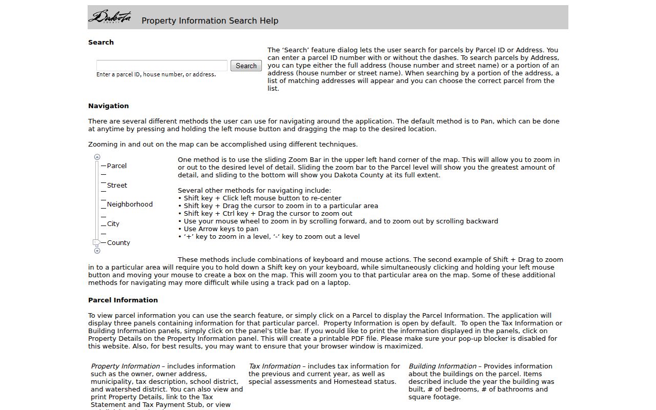
The help view supports a repeatable address-to-parcel workflow, while the returned parcel card supplies the facts that need to be checked for each Lakeville street address.
Lakeville Street Parcels on the Map
The county's online property maps add the map relationship that a property card cannot show by itself. County layers include parcels, aerials, contours, floodplains, trails, parks, and road projects. For a street-directory task, turn on the parcel boundary layer, identify the target site, and use the adjacent polygons only as separate parcels to research. A site address, municipality, plat or legal description, and tax fields can be returned by the GIS service, but the geometry has no occupancy roster.
It is normal for a Lakeville tax mailing address to differ from the situs address. The mailing recipient may be an individual, trust, business, or another address. A homestead classification can be relevant context for the tax account, but it is not a real-time confirmation of who is present. Keep parcel ownership, tax mailing, and physical occupancy as three separate columns in research notes.
View the Dakota County online property maps before making a street sample.
The image is a map-and-layer reference for a Lakeville street directory. It helps show where one parcel ends and the next begins, not who occupies either property.
Lakeville Street Records by Address
Address-keyed records answer different questions. The parcel card supplies the current tax and land frame. GIS shows the land's shape and related overlays. A recorded instrument carries parties and a legal-land description. City records may be keyed to an address or project, while older directories may describe a subscriber at a published address in a particular year. The table makes the access boundary visible before a Lakeville street directory search begins.
| Address record | Lakeville-area keeper | What it can establish | Access boundary |
|---|---|---|---|
| Property and tax detail | Dakota County Property Taxation & Records | Parcel ID, situs, tax owner, mailing address, legal, value, tax, building and district fields | Free online address or Parcel ID search |
| Parcel GIS | Dakota County GIS | Polygon, street address, municipality, plat/lot/block, and map context | Public viewer and query service; no household list |
| Deed, mortgage, or lien | Dakota County recorder | Grantor, grantee, instrument, recording date/number, legal description, book/page | RecordEASE online period plus office, books, and microfilm |
| Voter route | Minnesota Secretary of State | One registration match or a certified, authorized street-sorted list | Exact lookup or statutory request process |
| Historic directory | MNHS and Dakota County historical collections | Subscriber or address evidence for the volume's date | Print, microfiche, digitized, or research-service access |
The Parcel ID and legal description are the durable bridge from an address to recorded land instruments. The street name helps locate the site on the map, but it is not always the recorder's best key. Conversely, a street-sorted voter output does not replace title research. Use each system only for the role it actually records.
Lakeville Street Deed Trail
After identifying the parcel, take its legal description into RecordEASE. The county's online abstract index reaches back to July 8, 1993 and uses an account or paid-session model. Search by grantor, grantee, legal description, document type, and recording period when those fields apply. Record the document number, book/page, instrument type, recording date, named parties, and whether an image is available. The index is a finding tool; the recorded instrument and legal-description match are the stronger check.
Earlier material is not a dead end. Dakota County directs older work to the Hastings recorder office, deed books, microfilm, and staff research. The county office is at 1590 Highway 55 in Hastings, with a recorder/research line at 651-438-4597. It also offers copy routes in Hastings, the Northern Service Center in West St. Paul, the Western Service Center in Apple Valley, and by mail. The research notes say ordinary copies are $1 per page and certified copies are $10, so a county request may be a better choice than an unsolicited deed offer.
Lakeville Street Voter Access
Minnesota Voter Information is designed for a single registration match, not for walking down a Lakeville street. The search requires first name, last name, date of birth, and an address mode. In that mode, the supported fields include ZIP or county, city or township, house number, street, and a unit when applicable. The system is updated nightly, while registration changes can take time to appear. A no-match may reflect timing, spelling, address history, or another eligibility issue.
| MNVotes field or route | What the research supports | Lakeville street limit |
|---|---|---|
| First and last name | Required identity inputs for the lookup | Not a surname-only street browser |
| Date of birth | Required for a one-person match | Full DOB is not a public voter-list field |
| ZIP or county, city, house number, street, unit | Address matching fields in the selected mode | Used with the named person's match, not independently |
| Walking-list request | Street-sorted voter output through the SOS form | Lawful-use certification and delivery restrictions apply |
The SOS request form offers a local list for $30 or a statewide list for $46. It requires a signed certification from a registered Minnesota voter, and the street-sorted walking list covers the most recent six years. Minnesota law prohibits publishing voter-list data online in searchable form. That makes the form the lawful route for an authorized civic request, not a way to reproduce a Lakeville street directory.
View the Minnesota Voter Information lookup to see the matching inputs and address mode before any query is made.
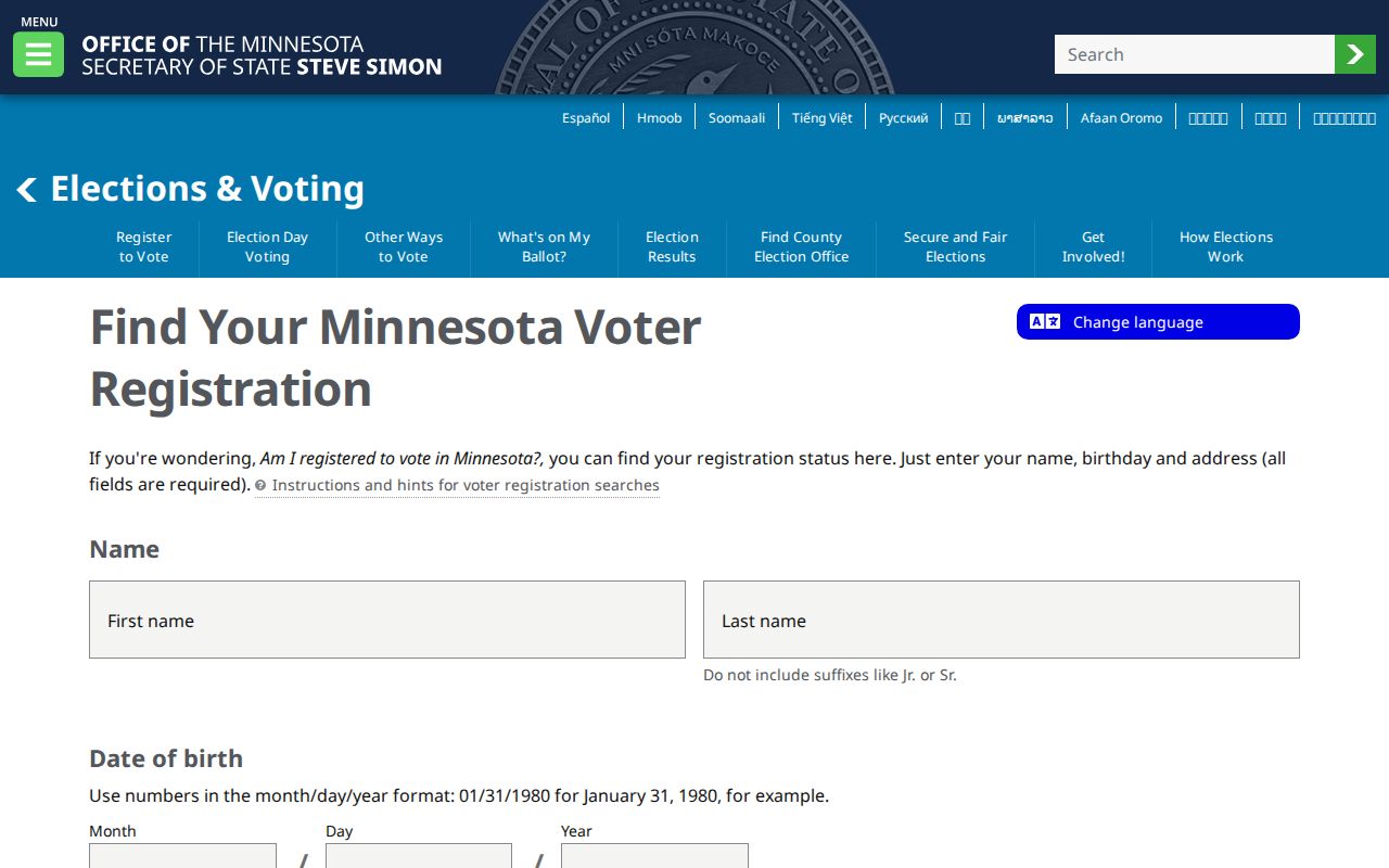
The interface confirms why an address alone is insufficient for the public voter lookup and why block-wide publication is outside the intended use.
Lakeville Street Directory ZIP Myth
A ZIP code is delivery geography, not a city boundary and not proof that a person resides at an address. Lakeville's official postal page identifies 55044, 55068, and 55024 as mailing ZIPs that can serve city addresses. The Rosemount and Farmington mailing areas can still be inside Lakeville. Use USPS to standardize a particular delivery address, then compare it with the county's situs address and municipality. Do not turn a ZIP return into a resident claim.
This distinction matters when a street-directory search produces a tax mailing address outside Lakeville. It may be the address for notices, an entity, or another household. The parcel's situs and legal description identify the land; the postal result identifies delivery formatting. Neither is a shortcut to every person connected with a street.
Note: preserve both the original historical address and the current normalized address when a directory or deed uses an older form.
Lakeville Street Directory Terms
The same Lakeville address can appear in several record systems with different labels. Keeping the terms separate prevents a map result from being mistaken for a directory entry or a recorded interest from being mistaken for present-day occupancy.
- Parcel
- A taxed piece of land identified by a county Parcel ID and represented as a polygon on the county map.
- Situs address
- The physical location used for the parcel, which can differ from the address where tax notices go.
- Plat
- A recorded subdivision map that can supply an addition name and lot/block relationship for a Lakeville parcel.
- Criss-cross directory
- A reverse-style directory organized from street and address toward a dated subscriber or household entry, when the volume includes that format.
MNHS holds Dakota County telephone directories from 1928 onward, including a Lakeville run from 1931 through later years, and Dakota County Historical Society has a digitized 1945 Central Telephone Directory. Those collections are historical evidence with gaps, changing exchanges, and subscriber conventions. A listed name can be a subscriber or head of household, not a universal account of everyone present.
Lakeville Street Record History
Lakeville research often crosses several record eras. Dakota County was established in 1849, Lakeville's municipal history begins with 1853 settlement, and later address work may appear in township, plat, county, or city sources. County historic-map series cover 1916–71, 1972–86, 1987–2004, and 2007–25. Pair an older directory or deed with the map series closest to its date instead of assuming today's street layout tells the entire story.
No verified citywide Lakeville street-renumbering year or annexation readdressing year was found in the reviewed material. The practical method is to retain an old number and spelling, compare the plat and legal description, consult dated county maps, and ask Dakota County Historical Society or Lakeville Area Historical Society for a local bridge. An absent online result should not be described as an absent historical record.
Lakeville Street Directory Boundaries
A Lakeville street directory cannot establish every person connected with an address. County parcels do not list all occupants. An unregistered person, a protected voter, a Safe at Home participant, a utility customer, a delivery recipient, or a driver-license address is not an open street layer. Units, multiple buildings, trusts, and business ownership also make simple one-address conclusions unreliable. Minnesota's Safe at Home program is a specific stop sign: do not try to discover or infer a protected address.
Use public records for personal, lawful research, property curiosity, historical work, or civic questions. Keep a source date and the record role with any note, and verify a consequential point with the custodian. Minnesota Government Data Practices Act access does not make every field suitable for broad redistribution.
Lawful use. Lakeville street records are for careful personal and civic research, not for watching, harassing, or intimidating anyone. Do not mirror street-sorted voter data or attempt to identify protected people.